Project Background
| Development Criteria | On-Site
Sewerage Permit | The
City of Cedar Park
| GIS Development Criteria for Cedar Park, Texas Geographic
Information Systems offer Communities an opportunity to describe the conditions
of the physical environment and model future alternatives (for development)
with information that prioritizes the existing community resources.
The landscape we live in is a complex blend of open spaces, tree covered
land, water, roads, and buildings, that are collectively organized in a
unique way we call home. |
|
The way we live is ever evolving and changing. Change
(they say) is inevitable, but some changes are not always in the best interests
of the local area. The message being: If we are not thoughtful with
new development, we will forever change the quality and value of the community.
Left to their own way..., development patterns organize
themselves around transportation and circulation patterns that, without
appropriate measures end in traffic congestion and often a diminished quality
of life (which reflects property value).
In determining appropriate future land uses, all lands
are not seen as equal in public value, so we must prioritize land "value"
(or the uses to which land is put)! Because many increased land value
opportunities and/or improvements are provided by public money, the land
cannot simply be divided and assigned its use considering single factors
such as ownership or access alone.
Land use activities and land development patterns are
a selected blend of preferences that define the qualities of the landscapes
that are to be protected or developed. Very often, not all situations
can be described in black and white terms, however, the following criteria
are recommended as a beginning point for determining appropriate restrictions
and guidelines to future growth in Cedar Park, Texas.
Five Suggested Categories for New Development
1) No Development Areas
These are Protected areas such as Wetlands, State Parks,
Neighborhood Parks, etc.
2) Very Restricted Development Areas
Areas that have the potential to flood.
3) Restricted Development Areas
Within 100 meters of areas adjacent to Ponds and Lakes.
Within 100 meters of areas that have the potential to
flood.
4) Areas of Limited (Residential, Commercial, or Industrial)
Development
Within 100 meters of areas adjacent to Annual and Perennial
Streams.
In best existing Agricultural land
5) All other Development by Permit.
In areas of existing overstory vegetation (oldgrowth
trees).
Specific Criteria responding to the Development
Categories (above).
"Click
on" the images for a more detailed view
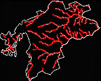
 |
Limited Development within 100 meters of areas adjacent
to Annual and Perennial Streams. |
 |
Restricted Development within 100 meters of areas adjacent
to Ponds and Lakes. |
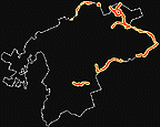 |
Restricted Development within 100 meters of areas that
have the potential to flood.
Very Restricted Development in areas that have the potential
to flood. |
 |
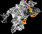
Limited Development in best existing Agricultural land.
SCS Soil types Crawford Clay, Denton Silty Clay, Farlie Clay, Sunev
Silty Clay. |
 |
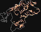
Permitted Development in areas of existing overstory
vegetation (Mature trees). |
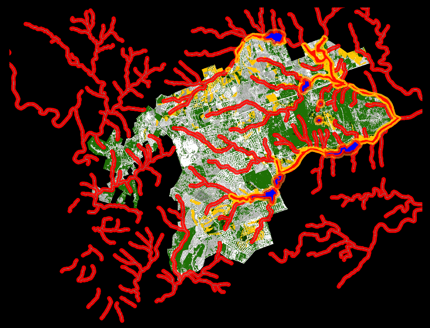
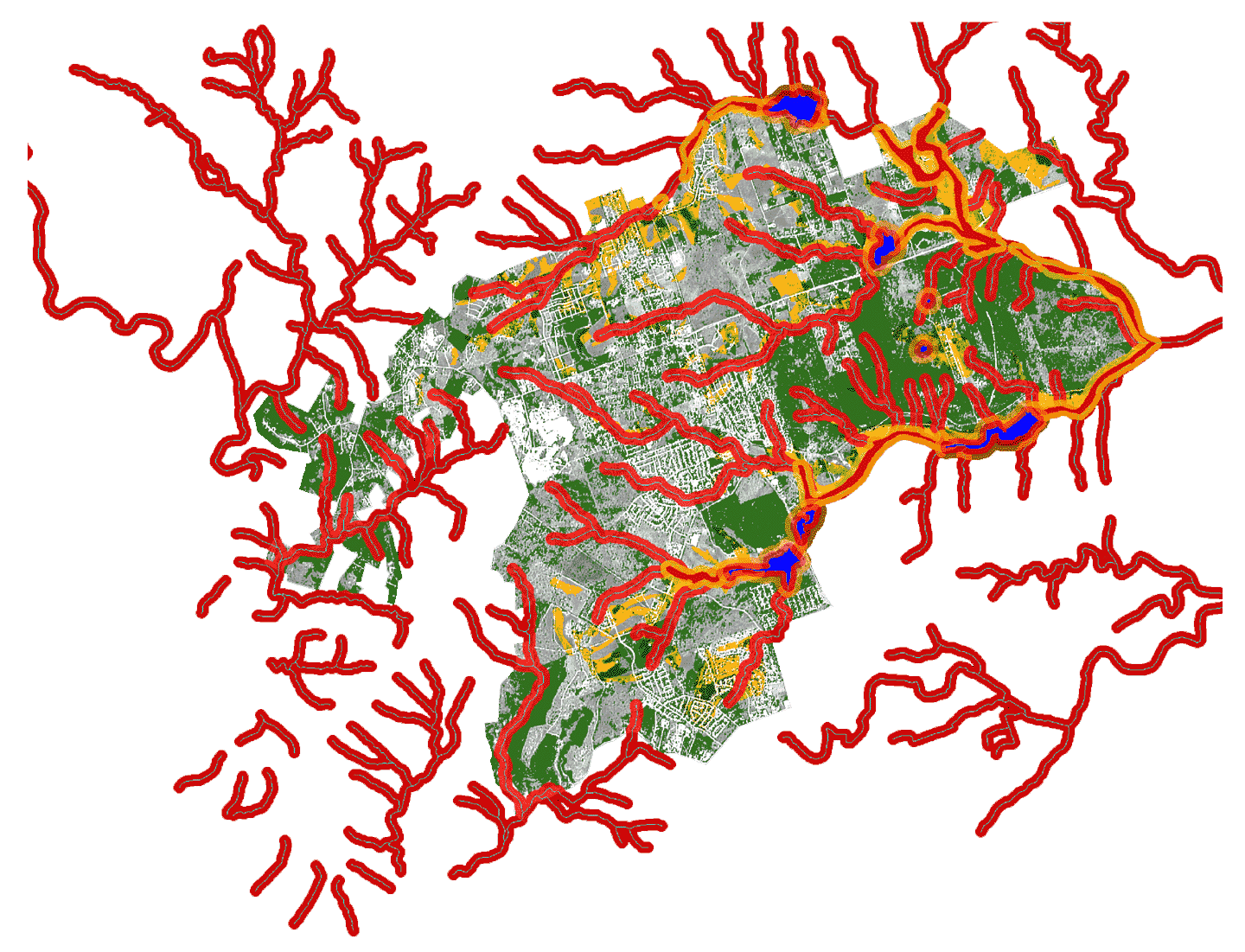
| The composite "solution" map is the "collective composite"
of the 5 criteria maps. Each individual criterion is electronically
applied "on top of" a 1992 Landsat/SPOT Satellite image merge used
as the backdrop for local reference. |
 |
Need a different image?
Map with legend and a white
background (best for printing on 8.5 X 11 paper).
Large map with black background
image (257K).
Large map with white
background image (257K).
Return to Homepage
All contents copyright
(C) 1997-1998, D. Fehler, C. Smith
All rights reserved.
|