

Coal is an organic-rich rock derived from plant material deposited in a swamp, marsh, or bog. Coal varies by grade (percentage of mineral impurities), type (organic composition), and rank (level of coalification). Rank describes the transformation from peat (unconsolidated plant remains) through lignite, subbituminous, bituminous, semianthracite, and anthracite coal (rock) from increasing burial pressure, temperature, and time.
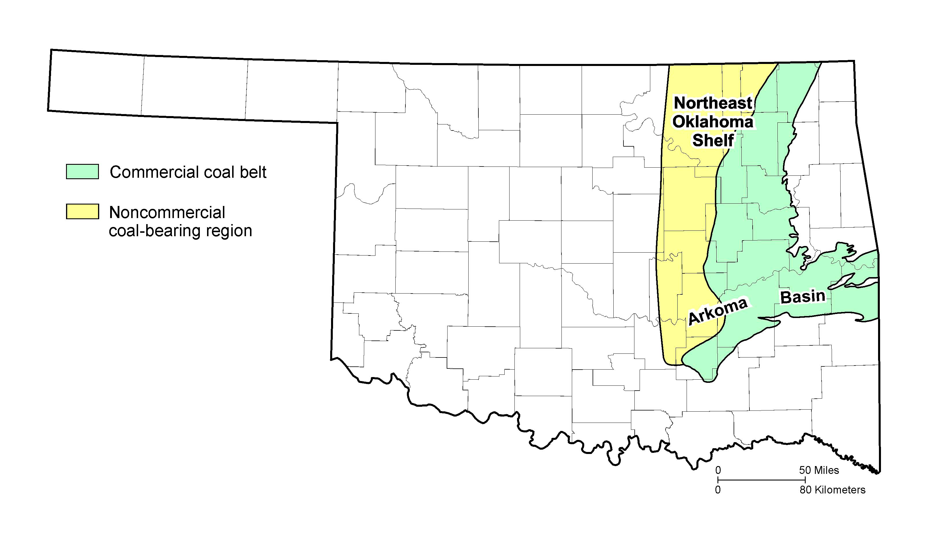
The coalfield in eastern Oklahoma (PNG) is divided into the northeast Oklahoma shelf and the Arkoma Basin based on physiographic and structural differences. The commercial coal belt contains coal beds ≥ 10 in. thick that are mineable by surface methods at depths < 100 ft and coal beds ≥ 14 in. thick that are mineable by surface and underground methods. The noncommercial coal-bearing region has limited information on coal thickness and quality or contains coals that are too thin, of low quality, or too deep for surface mining.
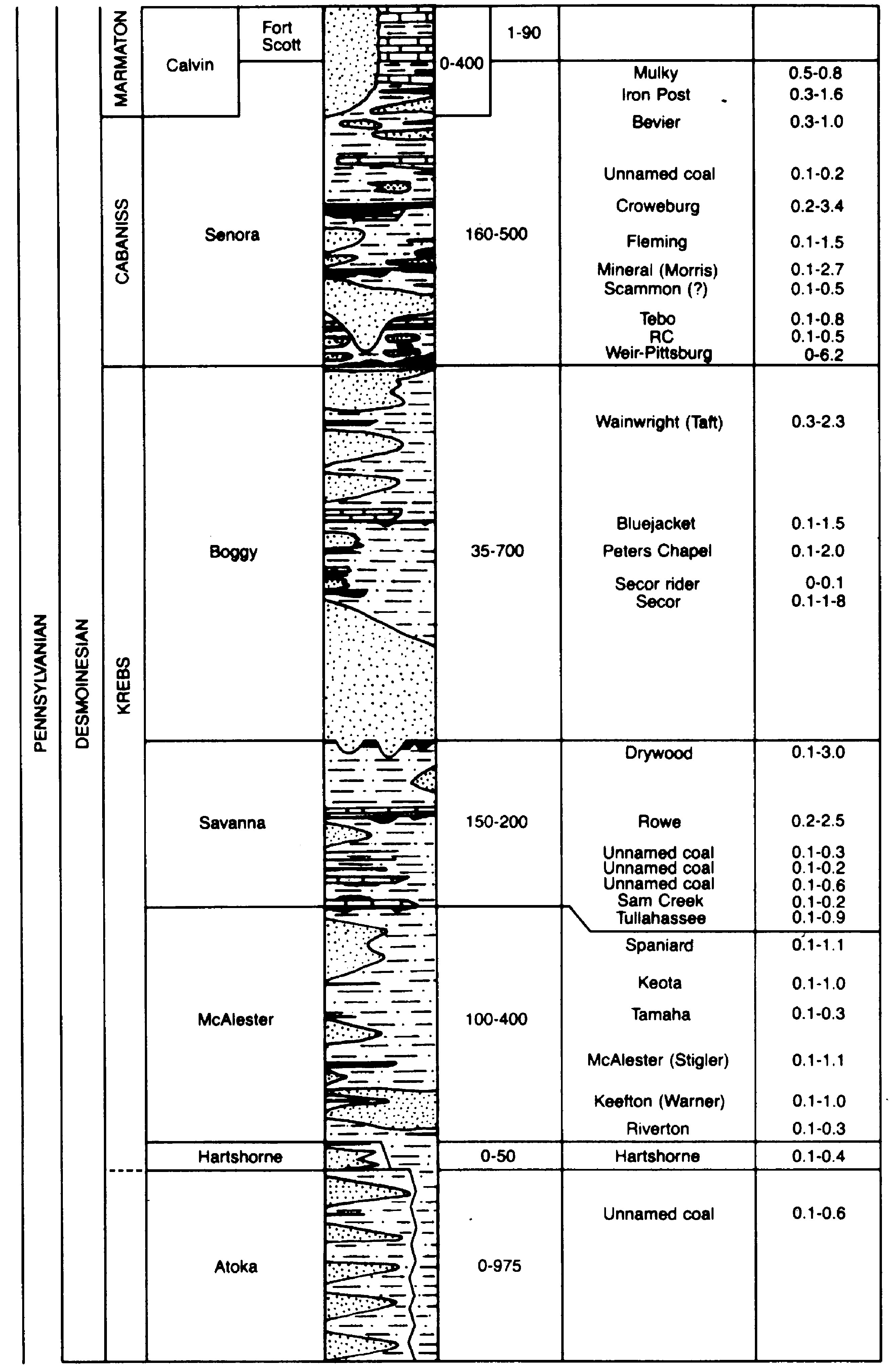
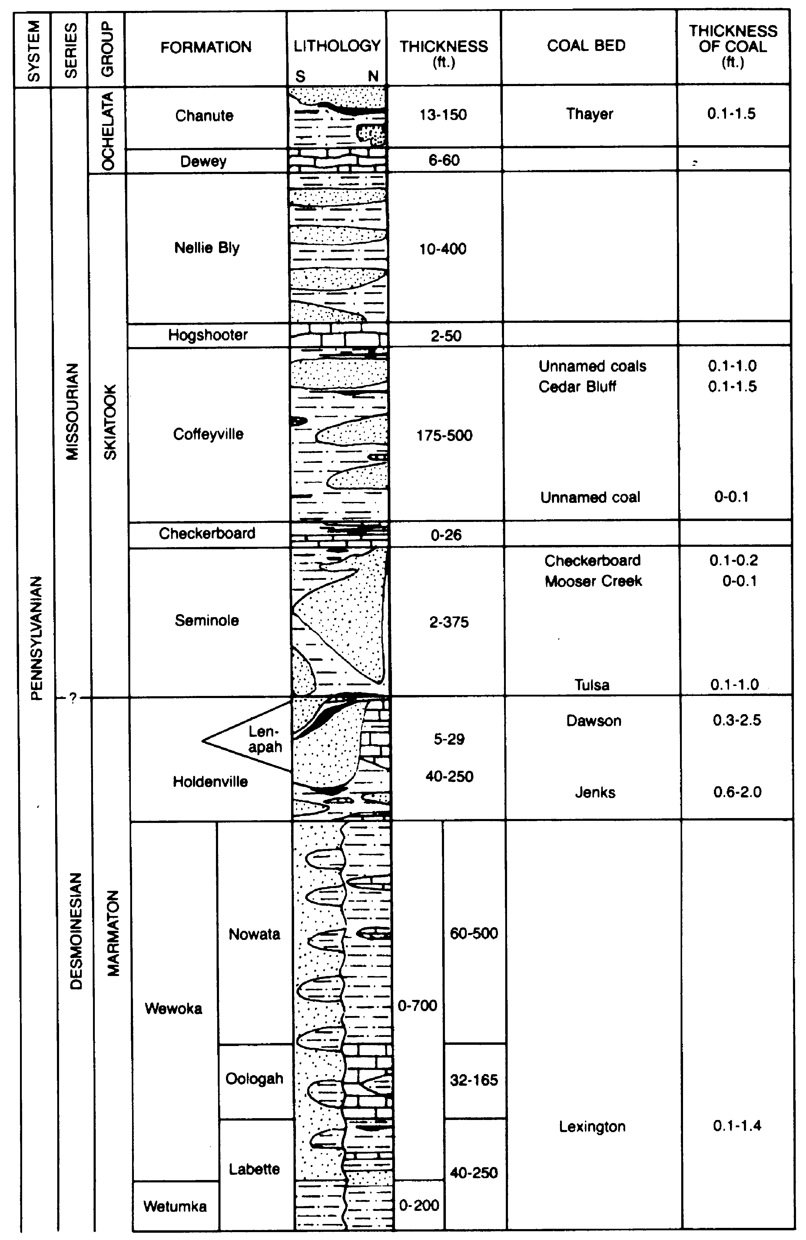
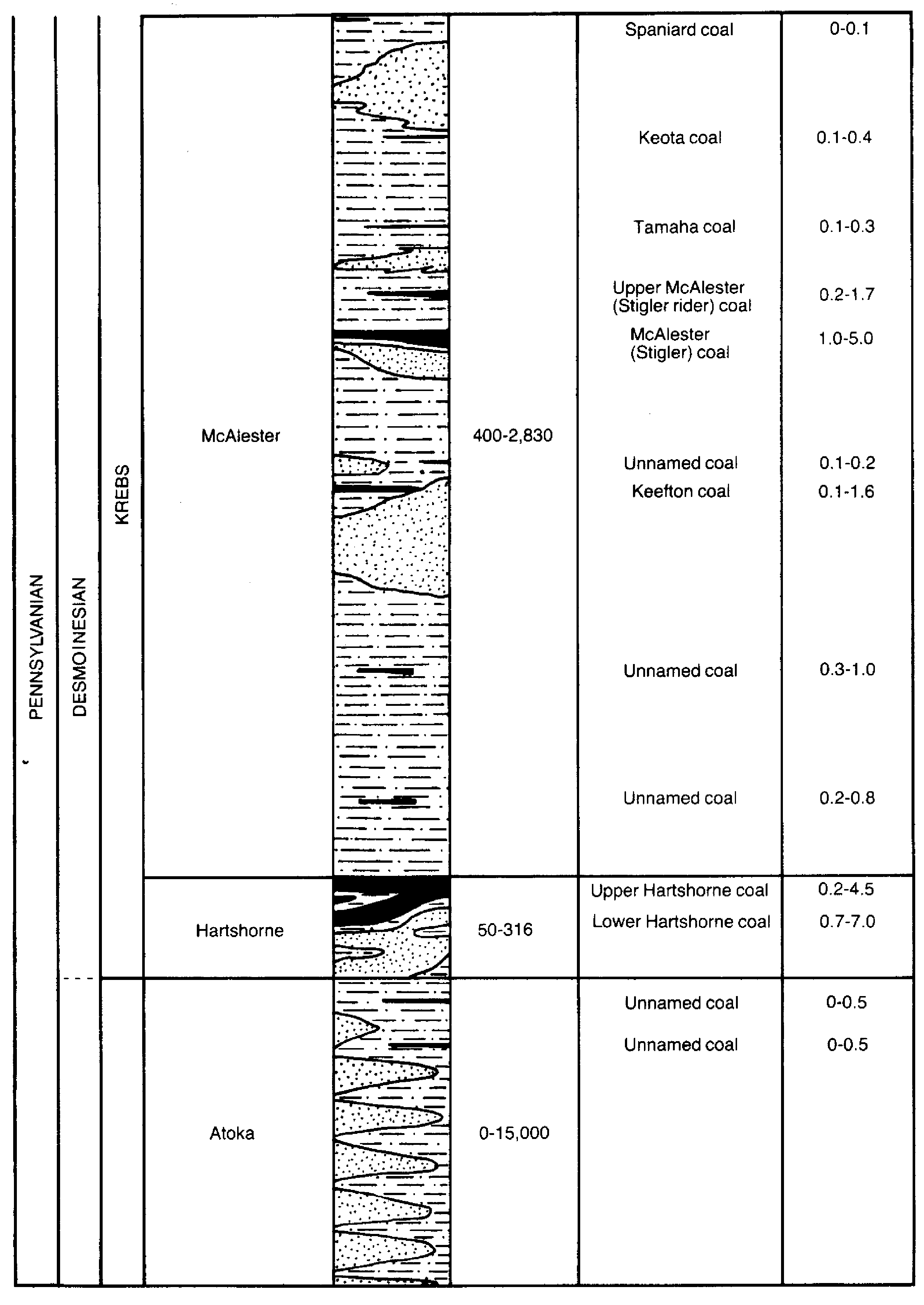
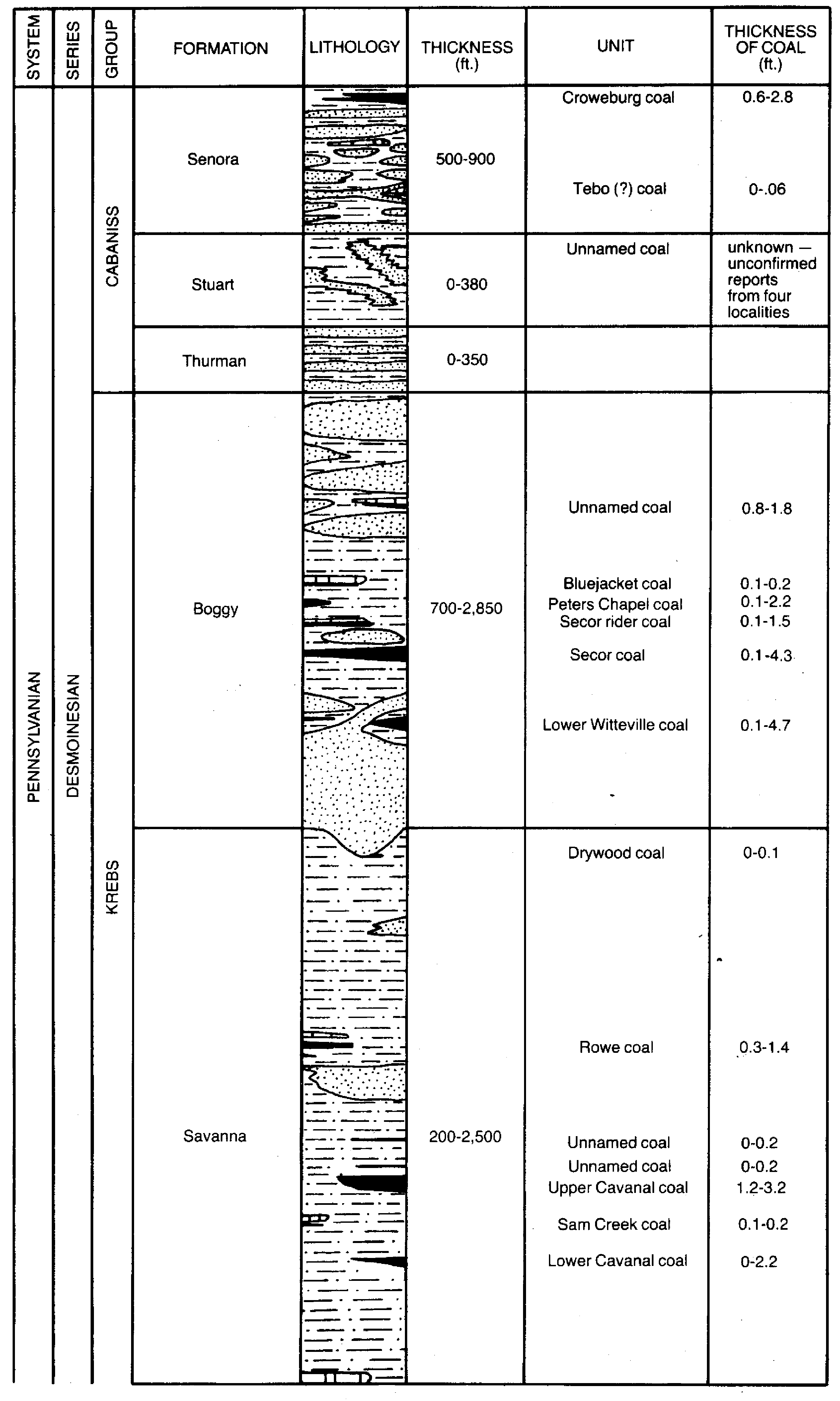
The age of commercial coal-bearing strata in the Oklahoma coalfield is Desmoinesian (Middle Pennsylvanian). Generalized stratigraphic columns of the northeast Oklahoma shelf (Lower (PNG) and Upper (PNG)) and Arkoma Basin (Lower (PNG) and Upper (PNG)) show about 40 named and several unnamed coal beds and their range in thickness measured from outcrops, mines, and shallow core samples.
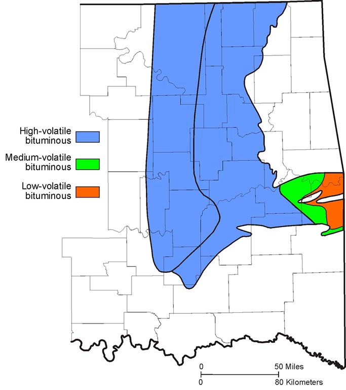
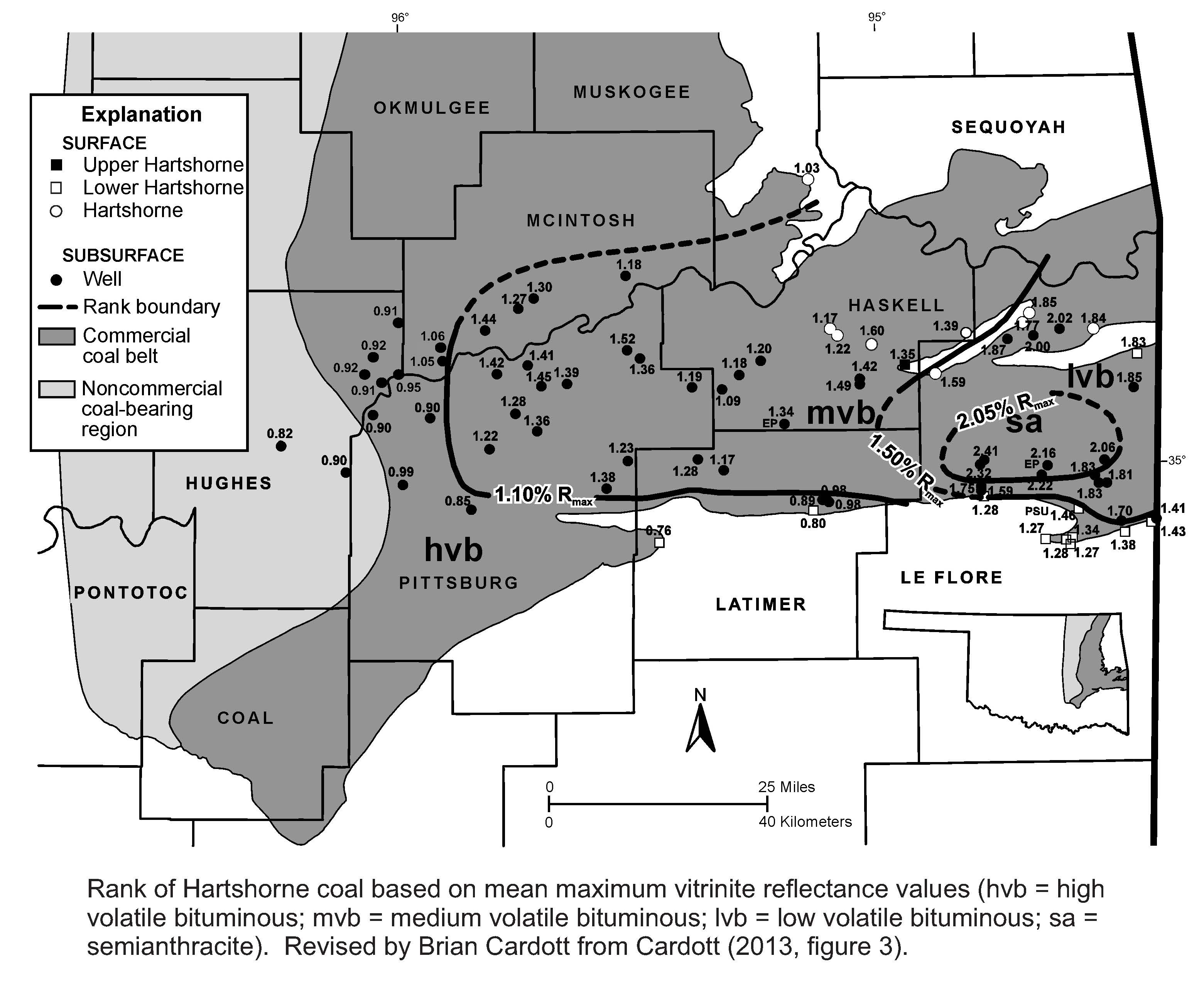
Coal rank (JPG) generalized for all coals at or near the surface, ranges from high-volatile bituminous in the northeast Oklahoma shelf and western Arkoma Basin to medium-volatile bituminous and low-volatile bituminous in the eastern Arkoma Basin in Oklahoma. Rank increases from west to east and with depth in the Arkoma Basin, attaining semianthracite rank in the Hartshorne coal (PNG).
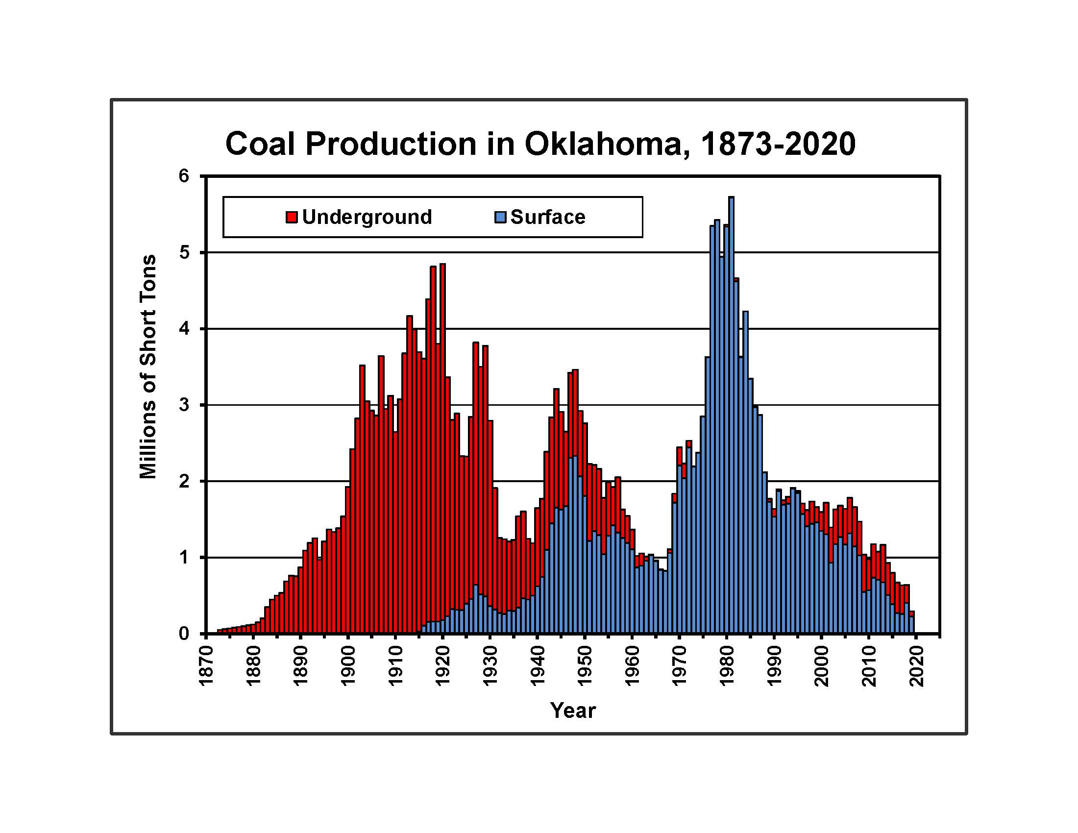
Remaining identified bituminous coal resources in beds ≥ 10 in. thick total 8.09 billion short tons (1 short ton equals 2,000 pounds) in 19 counties in eastern Oklahoma, an area of approximately 8,000 square miles. About 1.5 billion short tons of bituminous coal reserves (the economically recoverable part of coal resources) remain in Oklahoma. Oklahoma ranks 18th of 31 coal-bearing states in the U.S. based on coal reserves. From 1873-2020, 300.8 million short tons of bituminous coal were produced from underground and surface mines in the Indian Territory and Oklahoma. Peak annual coal production was 5.73 million short tons in 1981, with smaller production peaks during and immediately following World War I (4,849,288 short tons in 1920) and World War II (3,462,184 short tons in 1948). In 2019, 294,334 short tons of bituminous coal, the lowest annual coal production (PNG) level since 1883, were produced in Oklahoma from 4 mines (1 underground, 3 surface).
There are many uses for coal, primarily in combustion (generation of electricity), carbonization (coke used to make steel), conversion (gasification and liquefaction), and industrial (process heat). Coal is used in Oklahoma in electric power plants and lime and cement kilns (OGS Information Series 9 (PDF)).
Coal generates and stores large quantities of natural gas (methane). Coalbed methane activity in Oklahoma is in the northeast Oklahoma shelf and Arkoma Basin.


